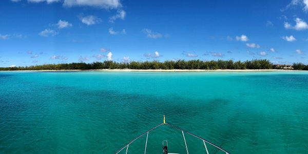
We left the islands in the Exuma chain and headed 53 miles east to Eleuthera when the weather allowed us to move. Eleuthera is a long skinny island – approx 180 miles long and in some places less than 1 mile wide.
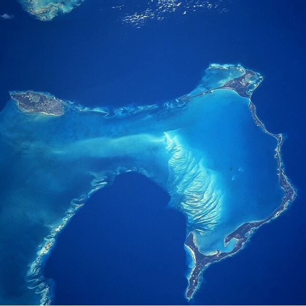 NASA image of Eleuthera, showing just how long and skinny it is. |
On our way over to Eleuthera we finally finally finally caught a fish. It is a bit embarrassing that we've gone this far into our trip and been unsuccessful but this was a good catch – a tasty mahi mahi (aka dorado).
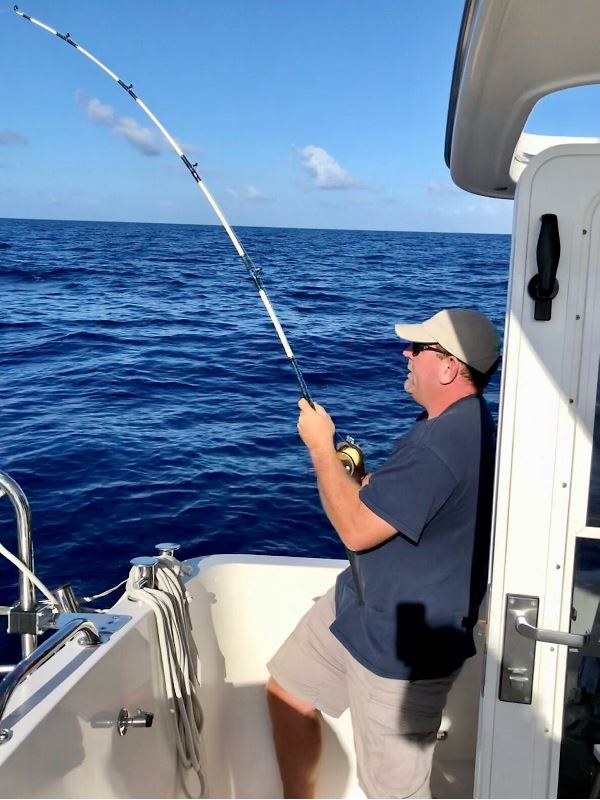 Kent is not going to let this fish get away. |
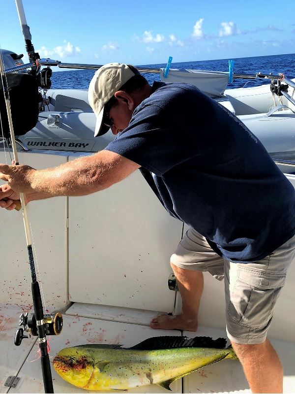 Fish safely on board but we were not prepared because considering our zero catching history why would we prepare? Usually we pour some cheap liquor down the gills to quickly put out the fish but that was down in storage so while the fish flopped around for a minute or two I ran to grab a mallet and find the booze. It must have been comical to watch us. |
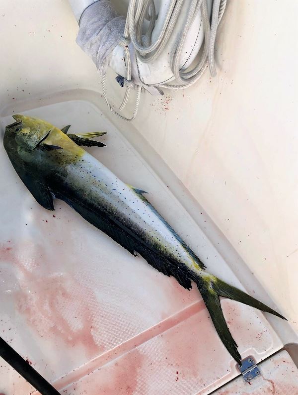 Less than 5 min on board and the mahi has already lost it’s well know bright color. I got to work remembering how to fillet a fish and then scrubbed down the boat. It looked like a horrific crime scene (could not even post some pics as it looked so gruesome). We enjoyed fresh fish for a few dinners and then froze the extra. |
Our first stop on Eleuthera was Rock Sound. We had explored Eleuthera last year and had a few favorite places to revisit but Rock Sound is more of a provision/get rid of trash stop for us. I did not even take any pictures, that is how exciting our 24 hr stay was for us. The good news is the main grocery store was well stocked and we continued our luck with finding fresh produce and dairy items at the stores we stopped in at.
The next morning we moved 25 miles north to Ten Bay anchorage. This was our #1 favorite anchorage last year and this year it lived up to the memory. Us along with Scaliwag were the only boats with a long white sandy beach, low tide sand bars, snorkeling, paddle boarding and swimming pretty much to ourselves. There are a few nearby vacation rentals but that only results in less than a dozen or so people on the beach. We stayed 2 nights but would have spent a week here if we could.
 Ten Bay anchorage. The fact that most boats pass by here is one of the reasons we like it so much because it feels like our own private place. |
 Sun setting behind Heartbeat (left) and Scaliwag (right). |
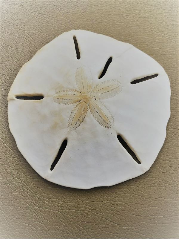 Brought a keepsake (which is the size of a baseball) back to Heartbeat from Ten Bay and will hang it to remind us of our favorite Eleuthera anchorage. We are not one to collect shells or take things off the beach but could not resist this one and it was far up way out of the water, not alive when I found it so I did not feel too guilty relocating it to our boat. |
Same story I have written about over and over again, we would have stayed longer but we were keeping an eye on weather later in the week and needed to keep moving. We begrudgingly left Ten Bay, heading north just 15 miles to Alabaster Bay which is our 2nd favorite anchorage in Eleuthera. There is a mile long white sandy beach, sand bars at low tide, good protection and clear waters. We stayed one night here but again would have liked to stayed longer if we could have.
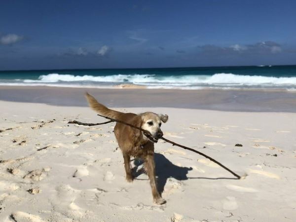 Penny loves stopping at Alabaster Bay. The pinkish colored sands on the ocean side are pretty. |
 The light pink sand barely does not really show up in pictures but most of the beaches around here are bright white and so a slight pink hue makes this beach a bit unique. |
About 1.5 miles from the anchorage is an abandoned naval base. We explored it last year and were excited to show it to Parker & Leslie (Scaliwag) as well as Eric & Jenny (Windsong). We stayed at the dock next to Eric & Jenny in Bimini for just over a week and had the opportunity to reconnect while at Alabaster. The short story of the base is that in 1950 the US built a base as a SOSUS (sound surveillance system) to track soviet submarines. Several years later the base was expanded and it became part of the Air Force Missile Test Centers Atlantic missile range. Coordinating with other stations around the Caribbean they were responsible for long range monitoring of rocket and guided missile launches, etc. In 1980 the base was decommissioned/abandoned.
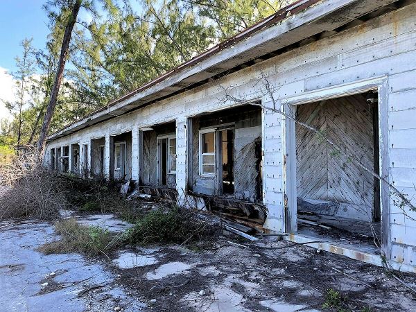
What remains are abandoned buildings with vegetation overtaking them. We spent a couple hours last year walking in/out of the buildings and it was just as much fun to do it again this year. It is a place that you could go explore every day for weeks and see something new each time.
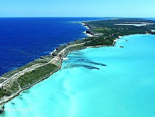
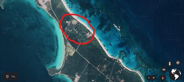 On the western side is a shallow bay and long sandy beach, this is Alabaster Bay where we anchored. The red circle outlines the abandoned base. It may not look like much but it takes a couple hours to explore on foot. The ocean side or eastern side beach has the (slightly) pink beach that goes on for miles. |
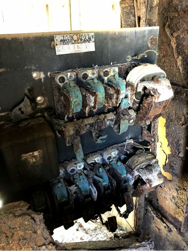 From inside the pump house near the beach. You can still see the General Electric sticker. |
 Officer’s Quarters. The view they had was spectacular as the windows face the ocean. |
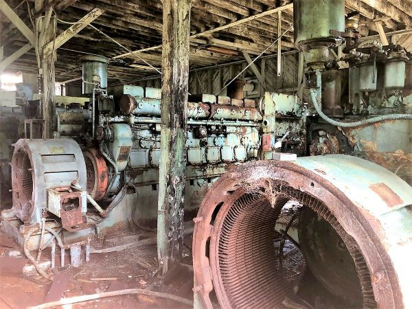 Generator Room – There are 6 or so massive generators that once supplied power to the base. Each of these were ~20 ft long and over 7 ft tall by our guess. It was one of our favorite buildings to walk through this year as well as last. |
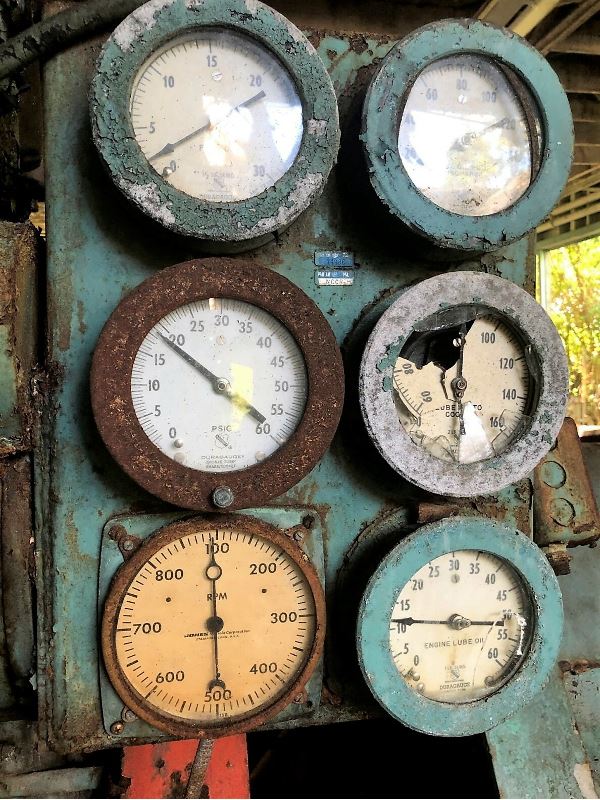 One can spend hours just looking at all the machinery, gauges, switches and the like here. |
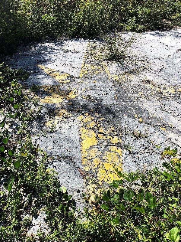 Road markings such as a center lane and even this compass rose still are visible today, 40 yrs after the base was abandoned. |
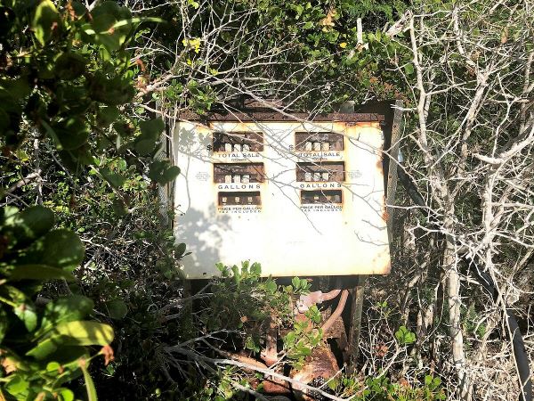 Gas pump, still showing the last price it had. Between last year and this year we both remarked at how much the greenery had taken over. |
This is a very cool site that shows the structures on base through pictures (both present and past) and some fun facts. You can easily click on the icons to explore it within Google Earth. http://www.projecteleuthera.org/ruins#TOC-NAVFAC-Eleuthera-Eleuthera-AAFB
From Alabaster Bay we made our way 20 miles to near The Glass Bridge and anchored for the night. We knew we needed to be up north in Spanish Wells for some nasty winds so this was a good stop to help us set up to travel through Current Cut at slack tide to arrive in Spanish Wells the following day. We snorkeled in the afternoon at our anchorage and even took the dingy a mile+ to a restaurant next to The Glass Bridge. They had great fish burgers there (we've learned to ask for fish burgers sans ketchup and mustard … just because it has the word "burger" in the name does not mean it should come lathered in ketchup and mustard – at least in our opinion).
 The Glass Bridge area. To the right the shallow Exuma Bank (where we anchored), to the left the deep Atlantic Ocean. On land there is a narrow bridge that you cross over and can look to both sides to see the water. It is a more stunning to see the waters in this aerial photo vs driving across the bridge. |
We left our anchorage as soon as it was light the next morning for Spanish Wells. In order to get to Spanish Wells we needed to travel though Current Cut at slack tide hence the early morning departure.
 The space showing between the land is Current Cut. It is fairly narrow but not a concern if you travel through at slack tide. |
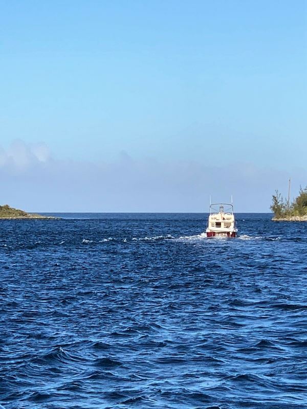 Scaliwag’s view of Heartbeat as we approached Current Cut. |
We are currently sitting at a marina in Spanish Wells waiting for the high winds to pass through. This year feels a bit more frustrating from a weather perspective but again we are down here early in the season and just have to make the most of it wherever we are!